
 |
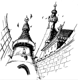
| Tukrah par Gilles Lautussier |
 |
| Carte de Ra'Ban d'Ig par Franz Vasseur |
--------------------------------------------------------------------------------
This article will discuss a small curiosity that French readers may have known about, but probably not non-French readers. I already mentioned in a past article the Pour la Gloire d'Ulric! supplement published in October 1995 by Jeux Descartes, the official French publisher of WFRP at the time. This is not the only exclusive resource for Warhammer that Descartes has published without an English equivalent: Descartes has published a number of magazines containing scenarios and game aids for games as varied as Star Wars, Chtulhu, Shadowrun, James Bond, Battletech... and thus Warhammer. Several articles published in this way concerned Araby, including information on the economy, adventure hooks, several of which were used in Perilous Sands, and a scenario of several pages called Ra'ban D'ig, the nation of the sun published in Descartes Le Supplément N°6 in March 1994. Written by Denis Dupethuis and featuring some illustrations by Gilles Lautussier and maps by Franz Vasseur, the scenario is actually the one played by more than 100 players during the first French Warhammer Cup that took place in July 1993.
Published by Jeux Descartes at the time when the company was the official publisher in France, the article also mentions that the Warhammer trademark has been used here with the permission of the English publisher of the time, Flame Publications Ltd. As such, it could largely be considered as an official resource, since it was published in the same way as Pour la Gloire d'Ulric ! and at the same time. It is precisely for this reason that I used it for the Perilous Sands, unlike other French resources, such as the game aids published in Casus Belli for example. In addition to the proposed story, the article provides NPC profiles, maps and plans as well as a profile of an Arabyan galley. The map, in particular, served well to fill in a corner map of Araby in Perilous Sands, although I arbitrarily placed the location on the Gulf of Medes instead of the northern shores where it is likely the story originally took place. In particular, there is mention of a three-day journey between Luccini and Tukrah, which seems excessively short compared to the official maps of the Warhammer world and sea travel times in, say, the 16th century.
|
| Map of Ra'Ban d'Ig by Franz Vasseur |
And I take this opportunity to say that a WFRP2 version of this scenario is available on the Ressources page! The only changes, besides an adaptation to the layout and rules of the second edition of the role-playing game, concern the duration of the journeys and some elements to insert it more widely in the Perilous Sands, notably concerning the map. The original map, which I used for the supplement (you will find the satellite city-states of Tukrah, present in the chapter on trade) is opposite and gives an overview of how the space is organized.
C'est sympa de voir, par l'exemple, comment tu valides le statut officiel d'une source pour la prendre en compte ou pas. Les premières années de la licence doivent être particulièrement nébuleuses... -.-'
RépondreSupprimerExtrêmement nébuleux ! Warhammer n'est pas, à la base, un univers : c'est un système de jeu pour utiliser "nativement" les figurines Citadel produites pour d'autres univers et systèmes : Le Seigneur des Anneaux, D&D...Judge Dredd, Doctor Who ! L'univers ne s'est réellement constitué que plus tard, et a perdu des bouts au passage, comme par exemple les dieux du chaos des articles précédents qui sont des reliquats de cette époque...chaotique ? Ça mériterait un gros article à l'occasion, mais le blog Awesome Lies parle déjà très bien de l'Antiquité de Warhammer : https://awesomeliesblog.wordpress.com/
RépondreSupprimer